
BY: Robert Jowaiszas, Community Editor/Investigative Reporter
British influence in Rockland County began long before the American Revolution took shape. After Henry Hudson’s 1609 voyage opened the region to European maps and trade, the lands that would later become Rockland passed from Dutch control to the English in 1664.
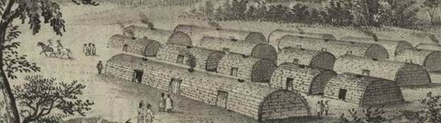
Under British rule, settlements slowly expanded across the river valley, with farmsteads, trading posts, and small hamlets developing alongside the Hudson and up into the Ramapo Highlands. By the mid-1700s, the county’s crossroads became strategically important, and British military officers, Loyalists, and Continental supporters all moved through the same villages, creating tensions that still echo in local history.
Daily life under British rule in Rockland was a mix of farming, trade, and household industry. British settlers raised wheat, rye, apples, and dairy cattle, ran mills along the Sparkill and Hackensack, and operated riverfront businesses from Nyack to Stony Point. Families lived in simple timber-frame or stone houses influenced by English rural design: steep roofs, small-paned sash windows, and central hearths. Clothing reflected practical English styles of the period—linen shirts, woolen coats, breeches, aprons, homespun dresses, and sturdy shoes made from local leather. Religion was centered in Anglican and Presbyterian traditions that emphasized community gatherings, scripture reading, and strong family structure.
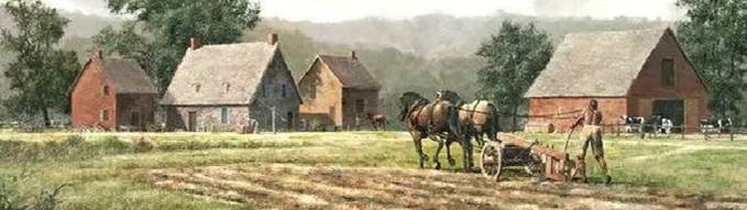
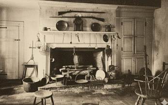
British-influenced homes in Rockland County were usually practical, modest, and built for hard work and family living. While Dutch homes favored heavy sandstone walls and broad Dutch doors, the British style tended toward lighter timber-frame construction with simple clapboard siding, steep rooflines, and small-paned sash windows. Interiors generally centered around one large fireplace where cooking and heat came together, with low-beamed ceilings, narrow staircases, and compact sleeping rooms above. Many homes featured small root cellars, outdoor bake ovens, shared family workspaces, and detached barns or sheds for animals and tools. This blend of English rural design with local Rockland materials created a plain but sturdy architectural style that lasted well into the 1800s, and traces of it still appear in older houses in Tappan, Haverstraw, and along the Nyack riverfront.
Women in British-era Rockland played essential but often unrecorded roles. They kept households running, managed gardens and dairy production, made clothing, preserved food, took part in church community life, and often operated small home-based trades such as spinning, weaving, candle-making, or bartering goods with neighbors. During the Revolutionary War years, women also carried news, hid valuables, supported soldiers passing through, and handled family farms when men were away.
Education during the British period was modest but growing. Small one-room schoolhouses appeared in Orangetown, Tappan, and Haverstraw, usually supported by local families. Lessons focused on reading, writing, Bible study, basic arithmetic, and practical work skills. Children were expected to help with chores before and after school, and their schooling often varied with the farming seasons.
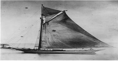
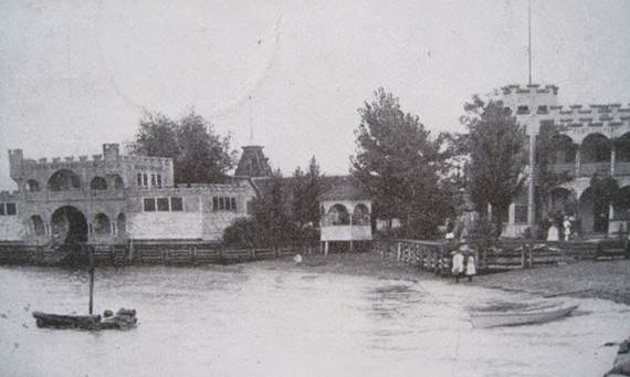
The Hudson River was central to daily life and commerce in British-era Rockland. Residents of Nyack, Piermont, and other riverfront settlements relied on boats to travel, trade, and communicate. Piermont became an important landing and ferry point, where farmers brought grain, dairy, and lumber to be loaded onto small sloops and barges headed downstream. Nyack developed as a riverfront village where locals docked cargo boats, ferries, and fishing vessels. The boats—mostly flat-bottomed sloops, ferries, and rowboats—were ideal for the Hudson’s tides and shallow banks, allowing goods, people, and even military messengers to move quickly. The river also provided recreation and learning: children swam, learned to row, and families visited neighbors across the water. Hudson River commerce made Rockland connected to the larger British-controlled Hudson Valley and New York City, reinforcing the county’s economic and strategic importance.
One of the most famous British figures connected to Rockland County is Major John André, the chief intelligence officer for the British during the Revolutionary War. In 1780, André was captured near Tarrytown while carrying plans from Benedict Arnold, who intended to surrender West Point to the British. After his capture, André was brought to Tappan for trial by a Continental Army tribunal.
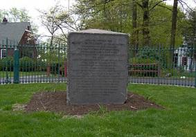
He was held at the ’76 House Tavern and tried at the Tappan Reformed Church, the same building where community members had gathered for decades. André was found guilty of espionage and executed on a small hillside just south of the church on October 2, 1780. At the time, the site was open farmland, and Continental soldiers erected a simple wooden gallows. Today, the André Monument marks the exact location near the intersection of Old Tappan Road and Andre Hill, where visitors still learn about this dramatic moment in Rockland’s history. His capture, trial, and execution remain one of the most studied events in the Revolutionary War and underscore Rockland County’s strategic importance.
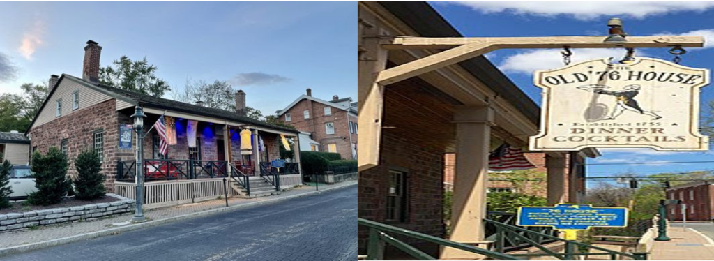
The ’76 House is directly connected to the André trial, serving as the building where André was held before his execution. Wikipedia+2NY State Archives Collections+2 These photos help readers visualize the tavern as it stands today and link to the Revolutionary War moment you describe.
Rockland County’s location along the western shore of the Hudson River made it a natural link between Manhattan and the rest of the Hudson Valley. Farmers, merchants, and travelers frequently moved between Rockland villages like Nyack, Piermont, and Tappan, and nearby counties such as Westchester, Orange, and Ulster. Goods produced in Rockland—grain, dairy, lumber, and bricks—were shipped down the Hudson River to Manhattan markets or to Albany for wider trade.
During the British period, Rockland’s position also made it strategically important. Troop movements, spy networks, and supply lines frequently ran through the county. British forces could move north along the river to Albany or south to Manhattan, while Continental troops used local roads, ferries, and riverboats to monitor British activity. Social and economic ties were strong as well. Families in Rockland often had relatives or business partners in Manhattan or other Hudson Valley towns, and churches, schools, and markets created shared community life across county lines.
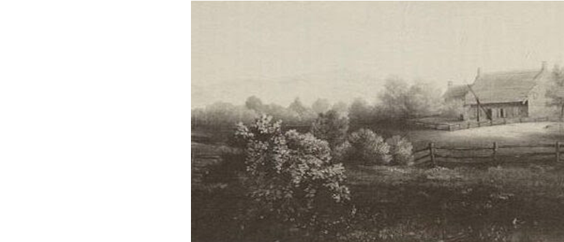
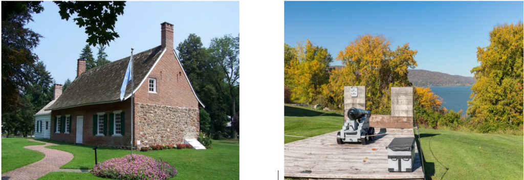
Rockland’s British-era landmarks still offer a direct connection to this history. The DeWint House in Tappan, where George Washington stayed while meeting with British representatives, remains one of the most important Revolutionary sites in the region. The Tappan Reformed Church, the ’76 House, the Old Stone Church in Upper Nyack, and the Stony Point Battlefield provide a clear picture of Rockland’s role in both British settlement and British American conflict. These surviving buildings reflect early colonial craftsmanship—stone walls, hand-hewn beams, simple shutters, and interior rooms built around large fireplaces where families worked and gathered.
The DeWint House is one of the oldest surviving structures in Rockland, built in 1700, and served as headquarters for George Washington during the Revolution. Wikipedia+2Rockland Daily+2 Use these images to show colonial‑era architecture, the stone/brick build, and current appearance.
For readers who want to explore more, the Historical Society of Rockland County (HSRC) offers archives, walking tours, and published research on both Dutch and British eras. The Library of Congress, New York State Archives, and the New-York Historical Society contain period maps, drawings, clothing illustrations, military documents, and images of British artifacts including buttons, weapons, household tools, and children’s items.
These combined resources help paint a fuller picture of Rockland County during British rule—its families, farms, homes, river trade, religious life, education, and the everyday people whose quiet labor shaped the community we recognize today.
References & Where to Find More Information
Historical Society of Rockland County (HSRC) — Offers archives, walking‑tour information, and detailed research on Rockland’s colonial and Revolutionary history. Their materials cover the DeWint House, ’76 House, and local historic markers. Explore Rockland+1
Maurice D. Hinchey Hudson River Valley National Heritage Area — Hosts information on historic homes and landmarks across the valley, including Rockland sites. Hudson River Valley+1
New York State Archives — Contains historic photos like 1948 shots of the Old ’76 House and other colonial-era structures. NY State Archives Collections
Piermont Historical Society — For early river‑town history, ferry landings, and the evolution of river commerce in Piermont and nearby settlements. Piermont Historical Society+1
Public domain and “Paths through History” registers — Many of the sites (DeWint House, ’76 House, local historic districts) are publicly documented with registries and maps. Rockland County Economic Development+2Wikipedia+2